The
Libyan Desert > History & Exploration > List of Expeditions
List
of Expeditions to the Libyan Desert
This
page provides a list of all historical expeditions to the Western Desert, to
the best of my knowledge, together with historical photographs and a list of
relevant literature.
1873-1874
winter

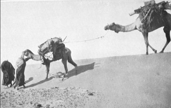
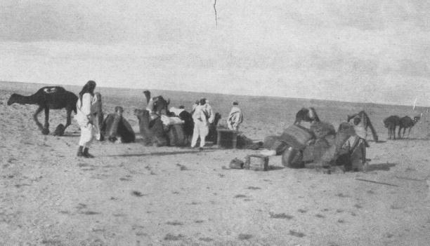
Rohlfs' cairn |
A
German expedition, led by Gerhard Rohlfs, and backed by the Khedive Ismail
of Egypt, attempts to cross the Great Sand Sea to reach Kufra from Dakhla
Oasis. Their heavily laden camel caravan is unable to cross the high dunes,
and the party is forced to turn north and travel in the dune lanes to Siwa.
At the point of the turn (named 'Regenfeld' on account of the rain shower
experienced there) Rohlfs builds a cairn and leaves a note of their visit,
dated 5th February 1874. Later, in 1879 Rohlfs succeeds in reaching Kufra
from the north as the first European. |
ROHLFS,
G., "Drei Monate in der Libyschen Wüste", Cassel 1875
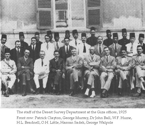
1900-1910
Llewellyn Beadnell surveys much of the Libyan Desert lying between the Nile
and the Egyptian oases.
BEADNELL, H.J.L., "The Sand-dunes of the Lybian Desert",
The Geographical Journal, Vol:25 (1910), pp:379-395
1907
January - June
The New York Museum of Natural History organises a fossil hunt expedition, led
by Walter Granger, to the Jebel Qatrani region to the north-west of Lake Fayoum.
Unpublished, parts of Walter Granger's expedition diary may be read on The
Granger Papers Project website, maintained by Vin Morgan
1909-1912
 |
W.J. Harding King makes several camel trips out of Dakhla Oasis , reaching
'Two Peaked Hill' some 200 kms to the South West of Dakhla in 1909. In 1911
He attempts to go further south, but only reaches 50 kms beyond 'Two Peaked
Hill', thwarted by a native guide loyal to the Senussi tampering with his
water supplies. He makes a remarkably accurate map of the Libyan desert
based on information gathered from natives, including the 'oasis' of Owenat.
He also predicts oases somewhere 400 kms to the south west of Dakhla based
on the stomach content of migrating birds. King published several articles
in the Geographical Journal, and wrote a book about his travels, published
in 1925. |
HARDING
KING, W.J., "Travels in the Libyan Desert", The Geographical Journal,
Vol:39 (1912), pp:133-137;192
HARDING KING, W.J., "The Lybian Desert from native information", The
Geographical Journal, Vol:42 (1913), pp:277-283;320
HARDING KING, W.J., "The Farafra Depression and Bu Mungar Hattia",
The Geographical Journal, Vol:42 (1913), pp:455-461;516
HARDING KING, W.J., "A Study of a Dune Belt", The Geographical Journal,
Vol:51 (1918), pp:17-33;251-258
HARDING KING, W.J., "Mysteries of the Lybian Desert", London, 1925
1916-1918
The British Light Car Patrols are formed to patrol the north western desert
frontier of Egypt against the Senoussi threat. In 1917 Siwa is captured from
the Senoussi by an armored car division making the crossing accross the desert
from the Mediterranean coast to Siwa in a surprise attack.
DUN, Major T.I., "From Cairo to Siwa across the Libyan
Desert with armoured cars", E. & R. Schindler, Cairo, 1933
1917

|
On
a surveying trip with the Light Car Patrols, John Ball & Moore discover
'Pottery Hill', later termed 'Abu Ballas' by Prince Kemal el Din. Skirting
the southern edge of the Sand Sea, Ball & Moore reach the broken foothills
of the Gilf Kebir without recognising the true nature of the plateau beyond. |
 |
 |
BALL,
John, "Problems of the Lybian Desert", The Geographical Journal,
Vol:70 (1927), pp:21-38; 105-128; 209-224 |
1920
November - 1921 February
 |
Rosita Forbes (disguised as a bedouin woman) and Ahmed Hassanein, with
a permission from Sayed Idriss al Senussi, make a visit to Kufra Oasis.
Rosita Forbes describes this remarkable journey in her book, 'Kufara,
the secret of the Sahara'
FORBES, Rosita, "Kufara, Secret of the Sahara", Cassel, London,
1921
|
1921,
1922-1923, 1924

|
Lt.Colonel N.B. de Lancey Forth makes several camel journeys into the Great
Sand sea, reaching 200 km to the south of Siwa, and Rohlfs' Ammonite Hill
from Bir Abu Mungar.
LANCEY FORTH, N.B. de, "More Journeys in search of Zerzura", The
Geographical Journal, Vol:75 (1930), pp:48-59 |
1923
January - June
 |
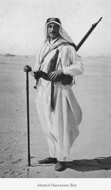
Starting from the Egyptian port of Sollum on the Mediterranean coast with
a camel caravan, Ahmed Hassanein crosses the Libyan Desert from north to
south via Kufra Oasis, reaching el Fasher in the Sudan. During this trip
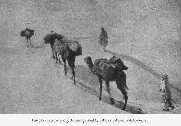
Hassanein discovers the 'lost oases' of Jebel Arkenu and Jebel Uweinat,
and makes first mention of the rock art at Karkur Talh. The account of the
journey was published in the Geographical Journal, the National Geographic
Magazine, and a book, 'The Lost Oases'.
|
HASSANEIN
BEY, A.M., "Through Kufra to Darfur", The Geographical Journal, Vol:64
(1924), pp:273-291; 353-393
HASSANEIN BEY, A.M., "Crossing the untraversed Lybian Desert", The
National Geographic Magazine, September, 1924 (Vol:46), pp:233-277
HASSANEIN BEY, A.M., "The Lost Oases", Century, New York & London,
1925
1923
September - October
Douglas Newbold explores the south Libyan Desert with camels, reaching the Wadi
Howar and Bir Natrun. On his way he discovers Jebel Tageru, with numerous rock
engravings.
NEWBOLD, D., "A Desert Odyssey of a Thousand Miles", Sudan Notes &
Records, Vol:7 (1924), pp:43-92
1923-1924
Prince Hussein Kemal el Din makes several desert trips with Citroen half-tracks
and Ford motorcars, accompanied by John Ball and Major Jarvis. In February 1924,
the party rediscovers Rohlfs' cairn and document at Regenfeld.
KEMAL el-DIN, Prince Hussein, "L'exploration du Désert Libyque",
La Geographie, 1928 , pp:171-183;320-336
KEMAL el-DIN, Prince Hussein, "Á la Recherche des Vestiges laisses
par l'Expédition Rohlfs dans le Désert Libyque", Bulletin
de l'Institut d'Égypte, 1925, pp:53-61
JARVIS, Major S.C., "Three Deserts", John Murray, London, 1936
 |
|
|
|
1925
January - March
Prince Hussein Kemal el Din, accompanied by John Ball, makes a motor car expedition,
starting from Kharga, via el Sheb and bir Terfawi to Jebel Uweinat. They continue
to Ennedi, and discover Merga Oasis on the return journey. Kemal el Din is the
first to make a scientific report on the numerous rock art sites he discovered
at Karkur Talh.
BOVIER-LAPIERRE, R.P. Paul, "Les Explorations de
S.A.S. Le Prince Kemal el Din Hussein", Bulletin de l'Institut d'Égypte,
Vol:10 (1927), pp:33-44
BREUIL, M. H., Prince Kemal el Dine, "Les Gravures Rupestres du Djebel
Uweinat", Revue Scientifique Illustre, Vol:66 (1928) pp:105-117
KEMAL el-DIN, Prince Hussein, "L'exploration du Désert Libyque",
La Geographie, 1928 , pp:171-183;320-336
1926 January-February
Prince Hussein Kemal el Din makes a second journey to Jebel Uweinat, this time
staring from Dakhla, via Abu Ballas (where he discovers some rock engravings),
then along a great plateau he names Gilf Kebir. From Uweinat he continues to Sarra
well.
BOVIER-LAPIERRE, R.P. Paul, "Récentes Explorations de S.A.S. Le Prince
Kemal el Din Hussein", Bulletin de l'Institut d'Égypte, 1930, pp:121-128
KEMAL el-DIN, Prince Hussein, "L'exploration du Désert Libyque",
La Geographie, 1928 , pp:171-183;320-336
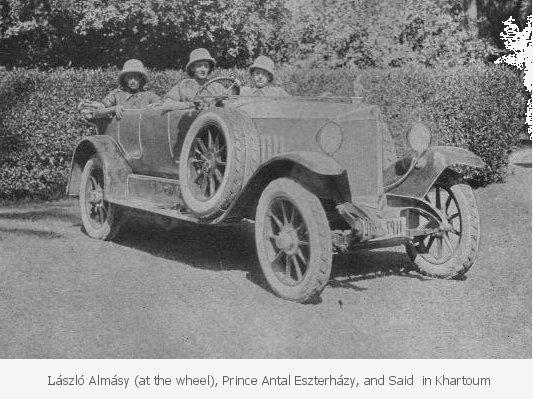
1926 March
László Almásy makes his first motorcar trip in Egypt, driving
along the Nile valley from Cairo to Khartoum with Prince Eszterházy.
They continue with their Steyr till the River Sobat in southern Sudan.
ALMÁSY, László, "Autóval Szudánba (With
Motorcar to the Sudan)", Budapest, 1928
1927 Spring (?)
Almásy drives from Cairo to Baharya, returning the following day.
ALMÁSY, László, "Az ismeretlen szahara" (The unknown
Sahara), Budapest, 1934 and "Levegõben, homokon" (In air and
on sand), Budapest, 1937 (The abridged version of the two volumes was published
in German as "Unbekante Sahara", Leipzig, 1939, re-published in Vienna
in 1997 as "Schwimmer in der Wüste")
1927 June
John Ball publishes his definitive article 'Problems of the Libyan Desert' in
the Geographical Journal, inspiring explorers for the next decade with the quest
for the mythical 'Zarzura' oasis.
BALL, John, "Problems of the Lybian Desert", The Geographical Journal,
Vol:70 (1927), pp:21-38; 105-128; 209-224
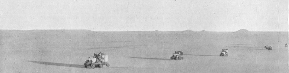
1927 autumn
Ralph Bagnold and company make a direct traverse with motorcars accross the desert
from Cairo to Siwa.
BAGNOLD, Ralph A., "Lybian Sands", Immel, London
1935
1927 November -December
Douglas Newbold and W.B.K. Shaw make a 1000 mile camel journey exploring the southern
part of the Libyan Desert (north west Sudan) from el Obeid to Wadi Halfa, definitively
mapping the region, and discovering several archaeological and rock art sites.
NEWBOLD, D., "Rock Pictures and Archaeology in the
Lybian Desert", Antiquity, Vol:2 (1928), pp:261-291
NEWBOLD, D., W.B.K. Shaw, "An Exploration in the South Lybian Desert",
Sudan Notes & Records, Vol:11 (1928), pp:103-194
1927 - 1928
H.J. Llewellyn Beadnell surveys the Egyptian desert south of Kharga Oasis and
west till Jebel Kamil, and sinks the well of Bir Missaha to test Ball's groundwater
theory (with success).
BEADNELL, H.J.L., "Zerzura", The Geographical Journal, Vol:77 (1931),
pp:245-250
1929 June
Almásy, with Prince Ferdinand Lichtenstein, drives from Wadi Halfa to Selima
Oasis, then follows the untraversed part of the Darb el Arbain till Kharga.
ALMÁSY, László, "By Motor Car
from Wadi Halfa to Cairo", Sudan Notes & Records, Vol:13 (1930), pp:269-278
ALMÁSY, László, "Az ismeretlen szahara" (The unknown
Sahara), Budapest, 1934 and "Levegõben, homokon" (In air and
on sand), Budapest, 1937 (The abridged version of the two volumes was published
in German as "Unbekante Sahara", Leipzig, 1939, re-published in Vienna
in 1997 as "Schwimmer in der Wüste")
1929 November
Bagnold and company explore the Sand Sea to the west and south west of Ain Dalla,
penetrating 100 kms into the Sand Sea due west, then reaching Ammonite Hill.
BAGNOLD, R.A., "Journeys in the Lybian Desert 1929
and 1930", The Geographical Journal, Vol:78 (1931), pp:13-39
BAGNOLD, Ralph A., "Lybian Sands", Immel, London 1935
1930 Spring (?)
Almásy conducts motorcar trials for the Sudan government between Wadi Halfa
and Uweinat
ALMÁSY, László, "Az ismeretlen
szahara" (The unknown Sahara), Budapest, 1934 and "Levegõben,
homokon" (In air and on sand), Budapest, 1937 (The abridged version of the
two volumes was published in German as "Unbekante Sahara", Leipzig,
1939, re-published in Vienna in 1997 as "Schwimmer in der Wüste")
1930 October -
November
Bagnold and
company traverse the Sand Sea from Ain Dalla, breaking out at the north west corner
of the Gilf Kebir, then continue to Jebel Uweinat. They return via Selima Oasis.
BAGNOLD, R.A., "Journeys in the Lybian Desert 1929
and 1930", The Geographical Journal, Vol:78 (1931), pp:13-39
BAGNOLD, Ralph A., "Lybian Sands", Immel, London 1935
1930-1931
Patrick Clayton carries the triangulation from the Nile valley to Jebel Uweinat.
On April 2nd 1931 on a single day he makes a 200 km run north along the western
edge of the Gilf Kebir till Wadi Sora point (he does not see the main rock shelters,
but discovers some faint engraved Giraffes near the mouth of the adjacent wadi)
CLAYTON, P.A., "The western side of the Gilf Kebir",
The Geographical Journal, Vol:81 (1933), pp:254-259
CLAYTON, Peter, "Desert Explorer", Cargreen, 1998
1931 January
The Italian army occupies Kufra. Many of the inhabitants flee to Uweinat, then
try to make their way accross the desert to Dakhla or the Nile. Hundreds perish
in the desert, many were saved by Clayton and the Mamur of Dakhla who mobilised
all the available motorcars to search for the wandering refugees.
ALMÁSY, László, "Az ismeretlen
szahara" (The unknown Sahara), Budapest, 1934 and "Levegõben,
homokon" (In air and on sand), Budapest, 1937 (The abridged version of the
two volumes was published in German as "Unbekante Sahara", Leipzig,
1939, re-published in Vienna in 1997 as "Schwimmer in der Wüste")
This Chapter was left out of the 1939 German edition, but included in the 1934
Hungarian and 1997 Austrian editions.
CLAYTON, Peter, "Desert Explorer", Cargreen, 1998
1931 August
Almásy purchases a de Haviland Gipsy Moth airplane to be used for exploring
the Libyan Desert in search of Zarzura. He makes arrangement with a Cairo - Cape
Town expedition, led by captain G. Malins, to make a detour and accompany him
to Uweinat and northern Sudan. Accompanied by Count Nándor Zichy, they
take off from Budapest on the 21st of August. Four days later they crash in a
storm near Aleppo. Both survive with scratches only, but the airplane is a total
wreck. The Syrian papers report them dead, and the Malins expedition leaves Cairo
without them. (De Haviland re-purchased the wreck, which, rebuilt, was sold to
Sir Robert Clayton East Clayton)
ALMÁSY, László, "Az ismeretlen
szahara" (The unknown Sahara), Budapest, 1934 and "Levegõben,
homokon" (In air and on sand), Budapest, 1937 (The abridged version of the
two volumes was published in German as "Unbekante Sahara", Leipzig,
1939, re-published in Vienna in 1997 as "Schwimmer in der Wüste")
1932 winter
The Sudan Defence Forces organises a major exercise to recconoiter Bir Natrun
and Merga oases (the supposed hideout of Guaraan bandits) involving aircraft and
motor car columns. The cars reach Bir Natrun, which is found deserted. Aircraft
report Merga to be uninhabited.
SDF documents, Public Records Office, London (unpublished)
1932 April
A major expedition is organized by Almásy and Sir Robert Clayton East,
with Patrick Clayton and H.W.G.J. Penderel, taking a Gypsy Moth aeroplane to the
western side of the Gilf Kebir. To replenish their water supplies, Almásy
makes a daring solo trip to Kufra and back. In the meantime, an aeroplane flight
reveals a vegetated valley in the northern Gilf Kebir. Attempts to enter the valley
on the ground fail.
ALMÁSY, László, "Az ismeretlen
szahara" (The unknown Sahara), Budapest, 1934 and "Levegõben,
homokon" (In air and on sand), Budapest, 1937 (The abridged version of the
two volumes was published in German as "Unbekante Sahara", Leipzig,
1939, re-published in Vienna in 1997 as "Schwimmer in der Wüste")
ALMÁSY, László, "Recentes Explorations dans le Desert
Libyque", Royal Geographical Society of Egypt, Cairo, 1936
CLAYTON, Peter, "Desert Explorer", Cargreen, 1998
RODD, F.J.R., "A reconnaissance of the Gilf Kebir by the late Sir Robert
Clayton East Clayton", Vol:81 (1933), pp:249-254
1932 October -
November
Bagnold and party drive to Uweinat (Bagnold, Boustead, Paterson & Shaw are
the first to reach the summit on 11th October), explore Jebel Kissu & Yerghueda
hill (where they discover rock paintings), then continue to Sarra Well, Erdi &
Ennedi before reaching El Fasher. On their return journey they explore parts of
the south Libyan Desert along the darb el Arbain till Selima and Wadi Halfa.
BAGNOLD, R.A., "A further journey through the Lybian
Desert", The Geographical Journal, Vol:82 (1933), pp:103-129
BAGNOLD, Ralph A., "Lybian Sands", Immel, London 1935
SHAW, W.B. Kennedy, "The Mountain of Uweinat", Antiquity, Vol:8 (1934),
pp:63-72
1932 October -
November
H.W.G.J Penderel makes several RAF reconnassaince flights over the Gilf Kebir
& Uweinat (lands to meet Bagnold & party at Jebel Kissu), discovers that
the Gilf is in fact divided into two parts by the 'Gap' a broad valley, apparently
reachable from the east by cars.
PENDEREL, H.W.G.J., "The Gilf Kebir", The Geographical
Journal, Vol:83 (1934), pp:449-456
1932 - 1934
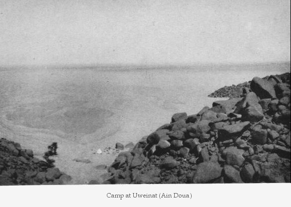
The Italians set up a permanent garrison at Ain Doua, claimed by Britain to lie
within Sudanese territory, but do not hinder the movement of British explorers
in the area.
BAGNOLD, Ralph A., "Lybian Sands", Immel, London
1935
1932 December -
1933 February
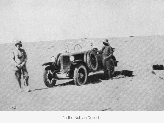
Patrick Clayton makes the first successful east - west crossing of the Great Sand
Sea from Ain Dalla (building 'big cairn' at the western edge), then proceeds south
to enter Wadi hamra and Wadi Abd-el Melik, the wadis glimpsed from the air in
the spring, but never entered on the ground. On his way south, at the southern
edge of the sand sea, Clayton discovers a curious mineral, the Lybian Desert Glass,
now thought to be the result of an extraterrestial impact.
CLAYTON, Peter, "Desert Explorer", Cargreen, 1998
1933 February
Orde Wingate
makes a camel trip into the Sand Sea starting from Abu Mungar, and returning to
Dakhla (and meeting Clayton on the way).
WINGATE, Orde, "In search of Zerzura", Vol:83
(1934), The Geographical Journal, pp:281-308
1933 February -
May
An Italian topographical mission led by Capitane Marchesi, and including professor
L. di. Caporiacco, survey Zieghen, Taiserbo and Buseima, then spend two months
at Uweinat making the first detailed survey and map of the mountain and adjacent
Arkenu. A party climbed the summit, calculated to be 1934 metres, and names it
Pico d'Italia (Marchesi placed the peak just inside Italian territory. Hitherto
it was assumed that this is the same spot as reached by Bagnold a few months earlier,
some kilometres inside Sudan, however our ascent in November 2001 ascertained
that Marchesi was correct: the highest point - measured 1932 metres with GPS -
lies exactly on the 25th Longitude, whereas Bagnold's high point is some 4 kilometres
to the west, and about 20 metres lower). Near the end of the mission Almásy
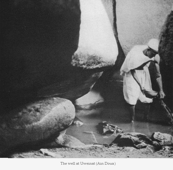
and di Caporiacco together discover the paintings at Ain Doua, and later enter
into a dispute on who is to claim the discovery.
"Italian Mission in the Libyan Desert (The Monthly
Record)", Vol:84 (1934), The Geographical Journal, pp:176
1933 March - April
In the company of Lady Dorothy Clayton (Sir Robert Clayton East's widow) Patrick
Clayton retraced his crossing of the Sand Sea, and explored the northern Gilf,
including the wadis. They made a side trip to Kufra, and concluded the trip by
driving north from the silica glass area to Siwa accross the Sanmd Sea.
CLAYTON, Peter, "Desert Explorer", Cargreen, 1998
1933 March - May
Almásy & Penderel, with austrian author Richard Bermann & photographer
Hans Kasparius, organise an expedition to explore the 'Gap' and the northern valleys.
At the start, Almásy, waiting for his companions at Abu Ballas, drives
north and finds the cairn at Regenfeld with the note of Prince Kemal el Din. They
discover the drivable 'Aqaba pass leading from the western plains up to the 'Gap',
and succeed entering two of the northern wadis, Wadi Abd -el Melik and for the
first time Wadi Talh. At the southern tip of the Gilf Almásy erects a memorial
to Prince Kemal el Din, his longtime patron who passed away the year before. Towards
the end of their trip, while camping at Ain Doua at Uweinat, Almasy discoveres
rock paintings on boulders above the spring (later the discovery was hotly disputed
with di Caporaccio).
ALMÁSY, László, "Az ismeretlen
szahara" (The unknown Sahara), Budapest, 1934 and "Levegõben,
homokon" (In air and on sand), Budapest, 1937 (The abridged version of the
two volumes was published in German as "Unbekante Sahara", Leipzig,
1939, re-published in Vienna in 1997 as "Schwimmer in der Wüste")
ALMÁSY, László, "Recentes Explorations dans le Desert
Libyque", Royal Geographical Society of Egypt, Cairo, 1936
BERMANN, Richard., "Historic problems of the Lybian desert", The Geographical
Journal, Vol:83 (1934), pp:456-470
CAPORACCIO, L. di, P. Graziosi, "Le pitture rupestre di Ain Doua", Edit.
centro di Studi Coloniali e Institi. Geogr. Milit., Firenze 1934
HOELLRIEGEL, Arnold (Richard Bermann), "ZARZURA, die Oase der kleinen Voegel",
Zürich 1938
KÁDÁR, László, "A study of the Sand Sea in the
Libyan Desert", The Geographical Journal, Vol:83 (1934), pp:470-478
PENDEREL, H.W.G.J., "The Gilf Kebir", The Geographical Journal, Vol:83
(1934), pp:449-456
1933 October -
December
Almásy leads Leo Frobenius & Hans Rhotert to the known rock art sites
at Uweinat & the Gilf Kebir, then on to the sites of the south Libyan Desert
discovered by Newbold & Shaw. During this trip a great number of new sites
are discovered, most importantly the two painted shelters at Wadi Sora, and many
unknown engravings and paintings at Karkur Talh. Rhotert published the results
of this expedition in 1952: "Libysche Felsbilder"
ALMÁSY, László, "Az ismeretlen
szahara" (The unknown Sahara), Budapest, 1934 and "Levegõben,
homokon" (In air and on sand), Budapest, 1937 (The abridged version of the
two volumes was published in German as "Unbekante Sahara", Leipzig,
1939, re-published in Vienna in 1997 as "Schwimmer in der Wüste")
ALMÁSY, László, "Recentes Explorations dans le Desert
Libyque", Royal Geographical Society of Egypt, Cairo, 1936
ALMÁSY, László, "Bir Bidi", Sudan Notes & Records,
Vol:18 (1933), pp:259-276
RHOTERT, Hans, "Libysche Felsbilder", Darmstadt, 1952
1934 March-April
Almásy leads a group of Cairo socialites and journalists to the Gilf Kebir
& Uweinat.
ALMÁSY, László, "Az ismeretlen
szahara" (The unknown Sahara), Budapest, 1934 and "Levegõben,
homokon" (In air and on sand), Budapest, 1937 (The abridged version of the
two volumes was published in German as "Unbekante Sahara", Leipzig,
1939, re-published in Vienna in 1997 as "Schwimmer in der Wüste")
1934
spring - summer
The Sudan Defence Force sets up a garrison at Karkur Murr, in response to the
Italian's claims to the Sarra triangle. (A party of the No.1. Motor Machine Gun
Battery reach the peak, as attested by their note found in November 2001)
SDF documents, Public Records Office, London (unpublished)
1934
July 20th
Britain cedes the Sarra triangle (formerly considered a part of Sudan) to Italy,
making the larger part of Jebel Uweinat (west of 25th East Longitude) a part of
Libya.
SHAW, W.B. Kennedy, "International boundaries of Libya",
The Geographical Journal, Vol:85 (1935), pp:50-53
1934 December
Patrick Clayton organises an expedition with L.J.Spencer, Keeper of Mirerals at
the British Museum, and other mineralogists to the Libyan Desert Glass area.
CLAYTON, Peter, "Desert Explorer", Cargreen, 1998
1935 January -
April
W.B.K. Shaw and party make an extraordinary journey, traversing virtually all
major parts of the Libyan desert. They start from Kharga, reach the Gilf Kebir
via Abu Ballas, make the first crossing of the dune belt in the 'Gap' to enter
Wadi Hamra, discover two major wadis transversing the southern Gilf (and locate
a cave with rock paintings on the col between them), then continue via Selima
and Erdi to El Fasher (where they meet Almásy and party). On the northbound
leg they traverse the southern Libyan Desert, continue to Uweinat, pass the western
side of the Gilf, then traverse the Great Sand Sea to reach Siwa. A member of
the party, Michael Mason described his experience in his book 'The Paradise of
Fools'.
MASON, Michael H., "The Paradise of Fools", London 1936
SHAW, W.B. Kennedy, "An expedition in the southern Lybian desert", The
Geographical Journal, Vol:87 (1936), pp:193-221
SHAW, W.B. Kennedy, "Rock Paintings in the Lybian Desert", Antiquity,
Vol:10 (1936), pp:175-178
1935 February -
March
Almásy leads a hunting party from Wadi Halfa, along the Darb el Arbain
to Wadi Howar, then on to El Fasher and back. Count Széchenyi makes an
account of the trip, "Rolling Sands".
MASON, Michael H., "The Paradise of Fools", London
1936
SZÉCHENYI, Zsigmond "Hengergõ
Homok (Rolling Sands)", Budapest, 1964
1935 April
In the company of Hans-Joachim von Esch, a German living in Alexandria, Almásy
explores the Great Sand Sea from Ain Dalla to Siwa, the last remaining 'blank
spot' untouched by earlier explorers or Clayton's surveys.
ALMÁSY, László, "Az ismeretlen szahara" (The unknown
Sahara), Budapest, 1934 and "Levegõben, homokon" (In air and
on sand), Budapest, 1937 (The abridged version of the two volumes was published
in German as "Unbekante Sahara", Leipzig, 1939, re-published in Vienna
in 1997 as "Schwimmer in der Wüste")
1935 December 20th
Almásy refused permission by Sudan Government to travel from Wadi Halfa
to Uweinat then on to El Fasher with prince Ferdinand Lichtenstein, due to suspicion
about him 'having friends on both sides of the border' (referring to both his
Italian and German/Egyptian friends, neither of which were looked upon favorably
by British authorities). After this rebuttal Almásy concentrates on setting
up a gliding and aviation school in Cairo sponsored by Taher pasha, and makes
only short desert trips with von Esch, mainly in the north.
Foreign Office documents, Public Records Office, London
(unpublished)
See the Almasy Documents page for details.
1938
February - March
Bagnold & the Egypt Exploration Society organise a scientific expedition to
the Gilf Kebir & Uweinat. Hans Winkler records rock art at Karkur Talh, Oliver
Myers excavates two main neolithic sites in the Gilf Kebir, in Wadi Bakht and
Ard al Akhdar. Bagnold & Shaw discover a new rock art site in Karkur Murr,
and one also in wadi Abd el Melik in the Gilf Kebir. The results are published
in Winkler's 'The Rock Drawings of Upper Egypt, vol. II.
BAGNOLD, R.A., O.H. Myers, R.F. Peel, H.A. Winkler, "An
Expedition to the Gilf Kebir and Uweinat, 1938", Vol:93 (1939), pp:281-313
MCHUGH, William P., "Some Archaeological results of the Bagnold-Mond expedition
to the Gilf Kebir and Gebel Uweinat, Southern Lybian Desert", Journal of
Near Eastern Studies, Vol:34 (1975), pp:31-62
WINKLER, Hans A., "The Rock Drawings of Soutern Upper Egypt II.", Egypt
Exploration Society, Oxford, 1939
1940-41
In 1940 July, Bagnold forms the Long Range Desert Group. Shaw, Patrick Clayton,
and many others of the former exploring trips are involved with the preparations
& subsequent exploits. In 1940 October the LRDG attacks and captures the Italian
post at Ain Doua. In 1941 January the LRDG and the Free French from Chad attack
Murzuq Oasis in Libya. In 1941 March the Italian garrison of Kufra surrenders
to General Leclerc.
BAGNOLD, R.A., "Early Days of the Long Range Desert Group", The Geographical
Journal, Vol:105 (1945), pp:30-46
SHAW, W.B.Kennedy, "The Long Range Desert Group", London, 1945
1941 June
The Kufra Garrison is taken over by the Sudan Defence Force, who set up a system
of convoys supplying Kufra from Wadi Halfa via Jebel Kamil, "Eight Bells",
then along the western side of the Gilf to Kufra. LRDG headquarters are moved
to Kufra, then to Siwa as action centers on the north coast.
SDF Kufra Garrison War Diary, Public Records Office, London
(unpublished)
SHAW, W.B.Kennedy, "The Long Range Desert Group", London, 1945
WRIGHT, J.W., "War time Exploration with the Sudan Defence Force in the Libyan
Desert", The Geographical Journal; Vol:105 (1945), pp:100-111
1942 May 4
3 Blenheim aircraft of the South African Air Force 15th Squadron stationed at
Kufra become lost and force land on their first training flight. Despite an extensive
air and ground search utilising all mobilisable forces, the aircraft are only
found 7 days later, by which time all but one of the 12 man crew are dead. A court
of inquiry convenes at the end of May in Kufra.
SAAF 15th Squadron Detachment War Diary, Public Records Office, London (unpublished)
SDF Kufra Garrison War Diary, Public Records Office, London (unpublished)
Court of Enquiry proceedings, RAF/SAAF (unpublished)
See SAAF Blenheims Page
for details.
1942 May 15 - 29
Almásy, assigned as a Hungarian Air Force officer to Rommel's staff, starting
from Jalo, takes two German spies, John Eppler and Hans Stansteade accross the
Gilf Kebir and Kharga to Assiut, and safely returns to Jalo. His feat may have
been unknowingly aided by the comotion caused by the loss of the three Blenheims.
The Kufra garrison, and the LRDG, alerted to his possible presence, only sends
out patrols to intercept him in early June.
ALMASY, László - Diary of "Operation Salaam", Imperial
war Museum, London (found by Michael Rolke, published as a supplement in the 1997
Austrian edition of Almasy's book, together with some photos of the raid found
by Michael in an Italian war journal)
EPPLER, John, "Operation Condor", McDonald & Jane's, London 1977
LRDG War Diary, Public Records Office, London (unpublished)
SDF Kufra Garrison War Diary, Public Records Office, London (unpublished)
SHAW, W.B.Kennedy, "The Long Range Desert Group", London, 1945
1962 August
The Royal Military Academy, Sandhurst expedition explored and mapped Jebel Arkenu,
and discovered several rock art sites ignored by previous explorers in favor of
it's larger neighbor, Uweinat.
WILLIAMS, M.A.J., D.N. Hall, "Recent Expeditions to
Libya from the Royal Military Academy, Sandhurst", Vol:131 (1965), pp:482-501
1963 November -
December
A joint archaeological survey expedition of the Southern Methodist University
and the Geological Survey of Egypt survey a large area to the west of the Nile
and south of Kharga, including Dungul Oasis, Bir Nakhlai and Bir Sheb.
HESTLER, James J., Philip M. Hobler, Rushdi Said, "Prehistoric settlement
Patterns in the Libyan Desert", University of Utah Anthropological Papers,
No. 92, Nubian Series No. 4, April 1969
1967 April
The US NAMRU-3 expedition spends some days at Uweinat studying its fauna and flora.
OSBORN, Dale J., Karl V. Krombelin, "Habitats, Flora, Mammals, and Wasps
of Gebel Uweinat, Libyan Desert", Smithsonian Contributions to Zoology, 1969
Number 11.
1968
November - 1969 January
The Belgian Scientific Expedition spends two months at Uweinat. In Karkur Talh,
they discover a series of rock shelters with paintings that are among the most
spectacular of Saharan rock art. Francis van Noten publishes the findings in his
book "Rock Art of the Jebel Uweinat"
LEONARD, J. et al, "Expedition Scientifique Belge dans le Désert de
Libye", Africa - Tervuren, Vol:15 (1969), No:4
VAN NOTEN, Francis, "Rock Art of the Jebel Uweinat", Graz, 1972
1972 - ongoing
The Combined Prehistoric Expedition, led by Fred Wendorf, carried out excavation
at several prehistoric sites in the southern part of Egypt: Bir Sahara, Bir Terfawi,
Dunqul Oasis, Nabta Playa. The work is ongoing at Nabta Playa.
WENDORF, Fred, et al., "Egyptian Prehistory: Some
new concepts", Science, Vol:169 (1970), pp:1161-1171
WENDORF, Fred, et al., "The Prehistory of the Egyptian Sahara", Science,
Vol:193 (1976), pp:103-114
WENDORF, Fred, Anthony E. Marks (eds.), "Problems in Prehistory: North Africa
and the Levant", Dallas, 1975
WENDORF, Fred, et al., "Late Pleistocene and Recent Climatic Changes in the
Egyptian Sahara", The Georgaphical Journal, Vol:143 (1977), pp:211-234.
1978
September - October
A multidisciplinary group including Farouk el-Baz, Vance Haynes and William McHugh
visits the Gilf Kebir & Uweinat, retracing Bagnolds' 1938 expedition. The
team made new exploration in Wadi Bakht and Ard-el Akhdar, and made a comparison
of desert landforms and those on Mars.
EL-BAZ, Farouk et al., "Journey to the Gilf Kebir
and Uweinat, Southwest Egypt, 1978", The Geographical Journal, Vol:146 (1980),
pp:51-93
1980 - ongoing
The Heinrich Barth Institut of the University of Cologne, under the auspices of
the B.O.S. project, led by Rudolf Kuiper, carried out surveys and excavation at
several prehistoric sites in the Libyian Deserts: Sitra Oasis, Great Sand Sea
& Silica Glass Area, Abu Ballas, Wadi Hamra, Wadi Bakht, Ard el Akhdar, Jebel
Kamil, Wadi Howar. The work is ongoing.
Link to the website of the Heinrich
Barth Institut
_________________________________________________________________
This
site is optimised for 600 x 800 resolution or greater and Microsoft IE5.
You may download images and other material for private use; for any other use,
please request permission.
© Fliegel Jezerniczky
Expeditions 1999-2002
Budapest, Hungary
Site design by Claire Spottiswoode, Birding
Africa
Geography
| History
& Exploration | Rock
Art | Fauna
& Flora
News | 2002-3
Programme | Past
Expeditions | Practical
Info | About
FJ Expeditions
Space Images
| Links | Bibliography
_________________________________________________________________